Being part of the list of World Heritage Cities is a privilege, and San Cristóbal de La Laguna has the great honour of being part of it. The streets and houses that compose the city are an example of innovative urban planning, made by unique historical buildings that have been declared Cultural Heritage Sites.
History
San Cristóbal de la Laguna was founded in 1497 by Alfonso Fernández de Lugo. The last city is established in the Canary Islands (Spain’s first overseas territory) and takes its name from a shallow lake or marshy area (La laguna) drained in 1837.
The first settlers, mostly soldiers, did not receive any defined plots of land: the unfortified urban area was considered a public space where everyone could build.
Small houses were built around the Church of the Conception, in the upper town (Villa de Arriba), in the greatest disorder, without a general plan. This situation was regularised in 1502 in a plan based on the plans that Leonardo Da Vinci had drawn up for the city of Imole, and which was adapted by the ruler (Adelantado) for the area between his official residence and the church. Long main streets (Calles Reales) linked open public spaces and formed a grid on which the smaller streets were inserted.
 The lower town thus created (Villa de Abajo) spread rapidly, attracting the island’s ruling classes, and in 1515 it had more than a thousand inhabitants. In the 16th century, the monastic communities began to build the Church of Nuestra Señora de los Remedios (1511), the Hermitage of San Miguel (1506), the hospices of San Sebastián (1506) and Los Dolores (1515).
The Municipal Council (Cabildo) brought water to the city with its resources in 1521 and the first public buildings were constructed in 1525.
The city sought an official charter as early as 1514 and was only granted one in 1531. In 1554, the Municipal Council ordered the destruction of all reed buildings, in order to reduce the risk of fire, an important precaution, since at that time, the city had six thousand inhabitants, making it the largest city in the Canary Islands.
San Cristóbal retained this dominant political, religious and commercial position during the 17th and 18th centuries. The prosperity achieved is reflected in the buildings constructed during this period.
The economic and political centre was transferred to Santa Cruz in the 18th century, causing the decline of San Cristóbal, which retained only a religious and cultural role. A political renewal led to the establishment of the Supreme Court (Junta Suprema) of the Canary Islands in San Cristóbal in 1808, which ended abruptly five years later, when this body disagreed with the Provincial Parliament (Diputación Provincial) established in Santa Cruz de Tenerife and was dissolved.
The 20th century has seen St. Kitts regain some of its former role, thanks to the role of its University.
Description
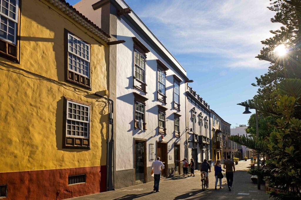
San Cristóbal is composed of two distinct parts: The Upper Town (Villa de Arriba) from 1497 and the Lower Town (Villa de Abajo) from 1502. The main street (Calle de la Carrera) forms the axis of the planned town, linking the first parish church with the Plaza del Adelantado. Parallel to this, Calle San Agustín forms the geometric centre of the city, lined with large houses built by the city’s first merchants.
Squares open up as you pass through, with regular shapes inspired by Mudejar models.
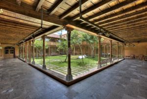
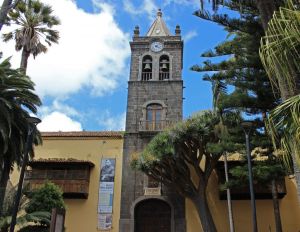
 The first church dedicated to the Immaculate Conception was completely demolished and rebuilt in 1511. It was reorganised and enlarged in several phases in the following years. The mixture of styles and the asymmetrical structures, tower, baptistery, chapels etc. that characterise its present form reflect its long history. Not far away, there is little left of the Monastery of St. Augustine, founded at the beginning of the 16th century (it still has a beautiful two-storey cloister).
The construction of the city’s new parish church was a long process, as the governor was interested in the development of the Lower Town, where work began in 1515 with the construction of the Parish Church consecrated to Los Remedios, a single nave building in the Mudejar style, with a tower attached in the 17th century, which later became the cathedral of the New Bishopric of Tenerife, established in 1813. The original façade collapsed and has been replaced by a neoclassical façade. Today the central nave is bordered by side aisles and several side chapels.
The Dominican convent of Saint Catherine of Siena was inaugurated in 1611. It became so important that it encompassed several neighbouring buildings. The facades of the church and other buildings are simple and austere, but the interiors are lavishly decorated.
The small Ermita de San Miguel has declined rapidly since its foundation by the first governor and was used as a warehouse until 1970, when the Tenerife Island Council restored it and converted it into a cultural centre. The remains of the Convent of Santa Clara, very prosperous in the 16th century, were largely destroyed by fire in 1697, serving also as a cultural centre.
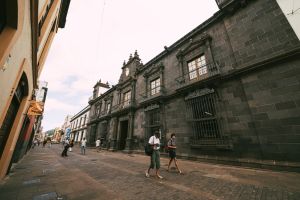
There are beautiful old residences in San Cristóbal de La Laguna. The oldest, the Casa del Corregidor, with its original carved red stone façade, dates from 1545. It is currently occupied by the municipal offices.
Similarly, the 16th century Lercaro house, with a remarkable mannerist façade, is currently the Museum of the History of Tenerife.
The house of Alvarado Bracamonte, also known as the House of the Governors, was built between 1624 and 1631 and used by successive governors as a residence and place of work until the 19th century. It has a red stone doorway, pilasters, a wrought iron balcony and a split pediment. It currently houses the city’s Artistic and Historical Heritage services.
 The 17th century Salazar house is very well preserved. Built in 1682, it has an elegant portal in an eclectic style, mainly Baroque but with Mannerist and Neoclassical styles. It now belongs to the Bishopric of Tenerife. The most striking feature of the Casa de Osuna, contemporary to the Casa Salazar, is the balcony on the first floor of its main façade; it now houses the enormous collection of archives of San Cristóbal.
Among the most beautiful buildings of the 17th century are the elegant Casa de Montañés, first a private residence and currently the seat of the Consejo Consultivo del Gobierno Autónomo de Canarias, and the “L” shaped house of the Jesuits, occupied by the Society of Jesus, until their expulsion from the Canary Islands in 1767, when it was given to the Sociedad Real de Amigos del País de Tenerife, who still occupy the offices. The Alhóndiga house was built at the beginning of the 18th century to serve as a corn market; at the beginning of the 19th century it was used as barracks for the French military and the District Court. Today it is occupied by municipal offices; its portal is particularly interesting.
San Cristóbal also has some beautiful examples of 20th century architecture such as the Palacio de Rodríguez de Azero (currently the Casino) and the Teatro Leal, both in an eclectic style.
ICOMOS observation and recommendations
The International Council on Monuments and Sites (ICOMOS), which visited the city in 1999, produced a nomination report in which it introduced this “statement of significance”, justifying the choice of San Cristóbal de La Laguna as a World Heritage Site.
- A city from the time of the Catholic Monarchs (Los Reyes Católicos), 1500.
- The city of one man, Governor Alfonso Fernández de Lugo.
- A colonial city representative of the mission of the settlers of a city-republic in a new land.
- An administrative city that illustrates a conception of the city, where the decisions of the public authorities and the municipal council (cabildo) are taken into account in the process of building the city.
- The first “peace” city. The first example of a city-territory, a precedent for American cities.
- The city as a project.
- Two cities and two periods of formation: the high city and the low city.
- Shape derived from navigation: a sphere and a board layout arranged along axes.
- A city completely controlled by regulatory measures.
- The layout of the streets is made in the image of the social structure: distribution.
- High point of the millennium in 1500; the reform of the clergy is reflected in the urban fabric.
- Dimensions as symbols: the resurrection and the end of time.
- A religious axis links the parish churches.
- The significance of San Cristóbal and La Laguna.
- The image of the city: the constellation of points on a navigational chart and the constellations of the sky.
The ICOMOS expedition report suggests slight modifications to the boundaries of the property, proposed for inscription, which were accepted by the competent authorities. Other suggestions, which were also accepted, concern the creation of an integrated system for the treatment of infrastructure services (e.g. electric cables), the transformation of certain main streets into pedestrian zones (accompanied by parking areas) and the search for the old pavements, which are now covered, in order to restore them.


