
The reproduction, crafted by hand with absolute fidelity to the manuscript, comprises more than sixty maps, coastal profiles, ethnographic scenes, and plans of the Canary Islands from the 16th century.
The collaboration with Coimbra allows for the exhibition of a legacy that, due to its fragility, cannot travel from the General Library of the Portuguese University.
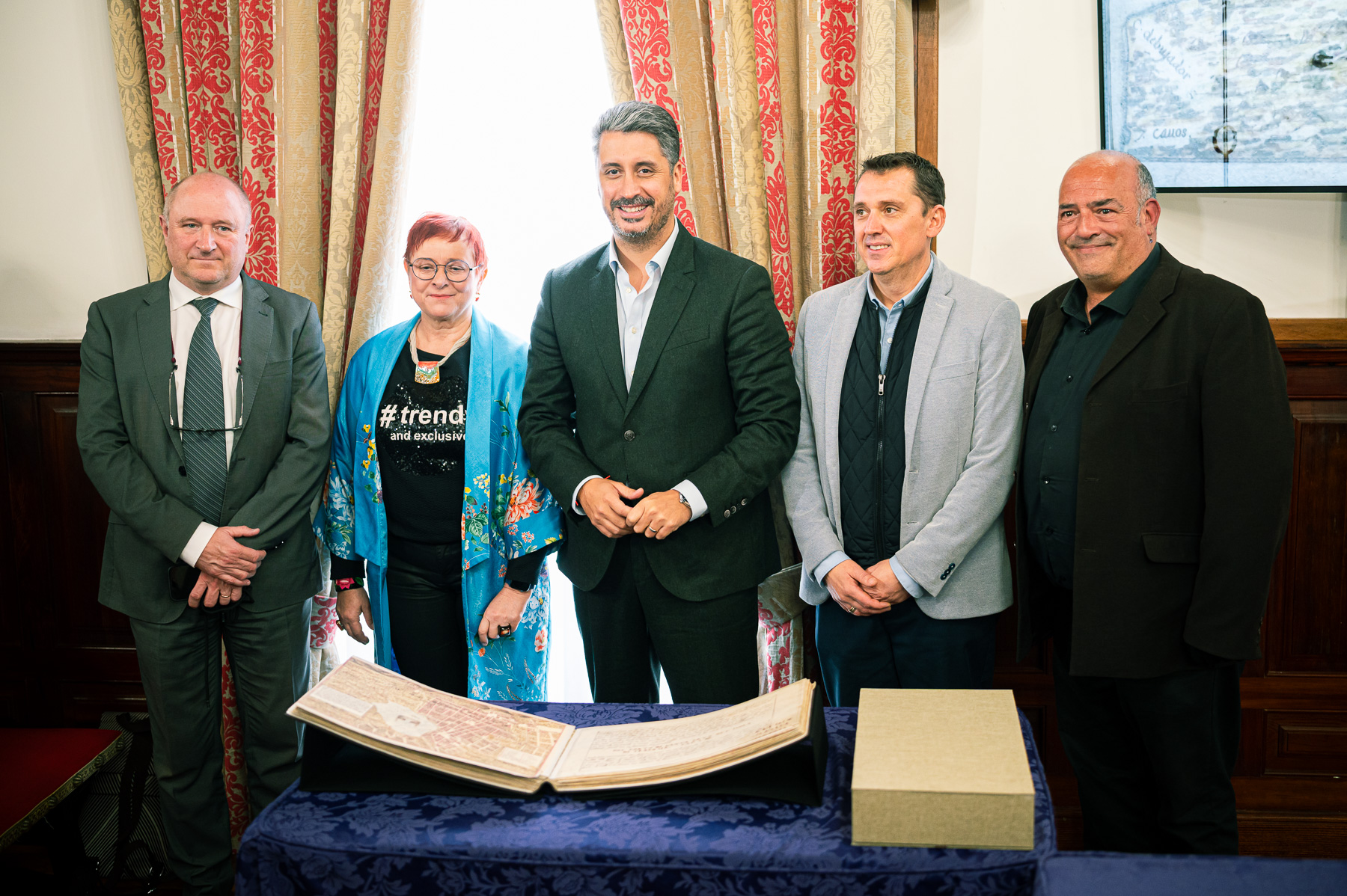
The plenary hall of La Laguna City Hall today hosted the official presentation of the facsimile of the Description of the Canary Islands, the seminal work that Renaissance engineer Leonardo Torriani produced between 1588 and 1592, commissioned by King Philip II. This work contains the earliest known map of the city, now a World Heritage Site. The event brought together representatives from various institutions, academic institutions, social organizations, and neighborhood associations.
The presentation included speeches by the Mayor of La Laguna, Luis Yeray Gutiérrez; the Deputy Director of the Faculty of Arts at the University of Coimbra, João Luís de Jesus Fernandes, whose participation was crucial in making this facsimile available to the city; and the Councilor for Cultural Heritage, Adolfo Cordobés, whose department spearheaded this initiative. In addition to the technical explanation provided by the reproduction’s author, conservator and restorer Katarzyna Zych, and historian Néstor Verona, who were directly responsible for the reproduction and study of the manuscript.
The Description of the Canary Islands is one of the most valuable testimonies of the archipelago’s historical heritage, a unique work that brings together the first scientific, urban, and territorial representation of the islands. The manuscript, created between 1588 and 1592, includes more than 60 illustrations encompassing island maps, coastal profiles, plans of cities and towns, ethnographic scenes, depictions of fortifications, traditional costumes, and elements of civil and military architecture.
It is an exceptional document that combines engineering, cartography, art, and naturalist observation, offering the first systematic and rigorous look at the geographical, social, and defensive reality of the Canary Islands in the 16th century.
Having an exact facsimile of this manuscript, made by hand and with absolute fidelity to the original kept at the University of Coimbra, represents a milestone for the city and for the Canary Islands, since it allows bringing to the public a document of enormous fragility that could never travel, reinforcing, at the same time, the historical, academic and cultural links between both university cities and recovering an essential piece of the identity of La Laguna.
Founding Memory
The mayor of La Laguna, Luis Yeray Gutiérrez, emphasized in his address that “this facsimile is not just a reproduction; it is a bridge between centuries, a gesture of recovering our founding memory, and a symbol of this city’s commitment to heritage preservation and academic research.” The mayor underlined that “La Laguna reconnects with its own origins through Torriani’s scholarly vision, which first established the Renaissance style that defines us to the world today.”
The deputy director of the Faculty of Arts at the University of Coimbra, João Luís de Jesus Fernandes, the institution that houses the original manuscript, celebrated the collaboration between the two university cities: “For our university, it is an honor to contribute to La Laguna’s access to a work that forms part of its historical identity. This project strengthens a historical relationship, one that also has its roots in the figure of José de Anchieta and that today projects itself into the future with new cultural and academic initiatives.”
For his part, the Councilor for Cultural Heritage, Adolfo Cordobés, highlighted the document’s heritage and scientific value. “The Description of the Canary Islands is one of the most extraordinary testimonies of the archipelago’s past. Having an exact facsimile, crafted by hand and according to museum standards, allows us to bring to the public a legacy that, due to its fragility, could never travel. This project is a tool for research, dissemination, and heritage education, which will be complemented by interpretive workshops led by specialists and its public exhibition.”
Katarzyna Zych, a conservator/restorer of graphic works, artist, teacher, curator, and head of the Restoration & Conservation company Papyri Ars, explained the reproduction process. “It has been a completely handcrafted work, done page by page, respecting every illustration, every marginal note, every mark of time, and even the damage caused by wood-boring insects on the original manuscript. The goal has been to create an exact scientific replica, allowing us to study and appreciate the work as it has come down to us.”
Historian and Professor of Historical Heritage at IRIARTE International University Center, Néstor Verona, coordinator of the project, emphasized the importance of this initiative. “Torriani didn’t just draw maps: he constructed the first scientific view of the Canary Islands. This facsimile allows us to understand how the urban, defensive, and cultural identity of the archipelago was shaped at a decisive moment in its history.”
The original work, preserved in the General Library of the University of Coimbra, is an extremely fragile manuscript. Therefore, the creation of this facsimile, commissioned to commemorate the 25th anniversary of La Laguna’s declaration as a World Heritage Site, is a cultural event of great significance for the Canary Islands.
Interpretive workshops and an exhibition
Following the official ceremony, the day will continue with the interpretive sessions “Leonardo Torriani’s La Laguna,” which will be held starting at 4:30 p.m. today, Wednesday, in the former Santo Domingo convent. These sessions are open to the public, with limited capacity. They will offer a multidisciplinary perspective, allowing for a deeper understanding of the historical, scientific, and cultural significance of the work.
The sessions will feature anthropologist Pablo Estévez, with the lecture “The Canary Islands Under the Sign of Torriani”; Katarzyna Zych herself, with “The Reconstruction of Memory: The Process of Creating the Facsimile of Leonardo Torriani’s Book (1590–1594)”; Professor José Luis Dólera Martínez, with “Mapping Time: The Urban Evolution of La Laguna”; and Colonel and researcher Juan Tous Meliá, with “Leonardo Torriani as Seen by a Cartophile.”
The project will reach its climax on May 15th with the opening of the facsimile exhibition at Casa Anchieta, a space that reinforces the historical link between La Laguna and Coimbra through the figure of Saint José de Anchieta. The exhibition, which will be held with all necessary security and conservation measures, will allow visitors to view the reproduction in a heritage setting of immense significance and is conceived as the beginning of a broader tour.
Furthermore, the Councilor for Cultural Heritage announced that efforts are underway to enable the facsimile to travel, in the future, to the various Canary Island cities depicted in Torriani’s maps, such as Las Palmas de Gran Canaria, Santa Cruz de Tenerife, Santa Cruz de La Palma, Teguise, Garachico, and San Sebastián de La Gomera, among others. All of this is aimed at bringing this exceptional legacy closer to all citizens of the archipelago and strengthening the dissemination of our shared heritage.


